Basics
Home and SearchSite Guide
Brentford Basics
Privacy Policy
Contact
People
FamiliesPhotos of people
Name indexes incl WW1
Memories
Lists, Documents, News
Occupations
Properties
Properties: High StreetProperties: non-High Street
Photos
Maps
1909/10 Valuation Index
Pub Hub
Can You Help?
Seeking...Mystery photos
Roads Off
A-Z listJanet's Research
HistoryBeach's Jam
Nowell Parr
Turner the Artist
Queen Victoria 1840
Brentford Market
80 High Street
Clitherow of Boston House
Four Croxford Brothers
Sources & More
They SaidBooks etc.
Web Links
Next
Site Technology
Author
Home and Search
Not Brentford
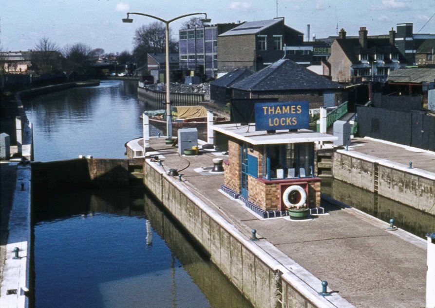
Thames Locks, Brentford
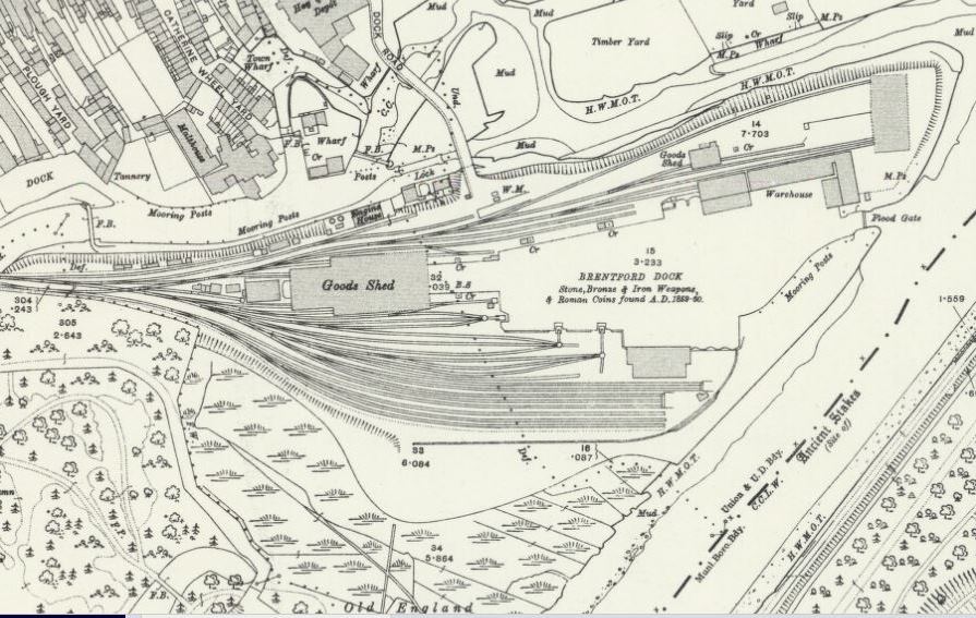
Peter Young took this photo at Thames Locks on 3rd April 1973, part of a collection of photos from 1973 and 1974 which show river traffic and people who worked on the waterways. If you are not familiar with the Thames Lock area the map below may help: |
The section above from the 1912 OS map, 25 inches to the mile, shows Thames Locks (marked 'lock') at the western end of Dock Road. Plough and Catherine Wheel Yards, running south from the High Street, and Brentford Dock are also marked. Gillian Clegg writes in Brentford Past that Thames Lock was constructed some time before 1818 near the junction of the canal and the Thames so that it was possible to access the canal at all times. Thames Lock was originally a single lock but was doubled and mechanised in 1962. The engine house, marked on the map near to the lock, contained steam engines which powered the cranes used in Brentford Dock (Carolyn & Peter Hammond, Then and now Brentford).
The photo below shows the view upstream, the footbridge visible in the distance and the building to the left could be the Brentford Dock Estate, which was occupied from 1977.
 |
Published May 2016; updated July 2016