Basics
Home and SearchSite Guide
Brentford Basics
Privacy Policy
Contact
People
FamiliesPhotos of people
Name indexes incl WW1
Memories
Lists, Documents, News
Occupations
Properties
Properties: High StreetProperties: non-High Street
Photos
Maps
1909/10 Valuation Index
Pub Hub
Can You Help?
Seeking...Mystery photos
Roads Off
A-Z listJanet's Research
HistoryBeach's Jam
Nowell Parr
Turner the Artist
Queen Victoria 1840
Brentford Market
80 High Street
Clitherow of Boston House
Four Croxford Brothers
Sources & More
They SaidBooks etc.
Web Links
Next
Site Technology
Author
Home and Search
Not Brentford
Brentford Redevelopment, January 2022
The south side of New Brentford is being redeveloped by Ballymore and Janet McNamara is keeping a photographic record.
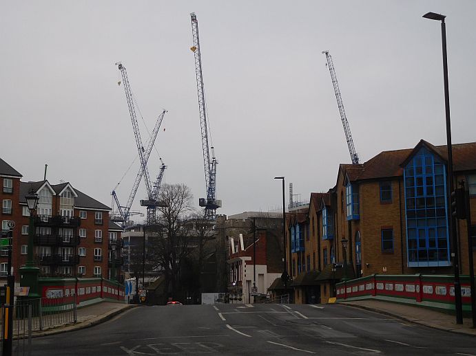
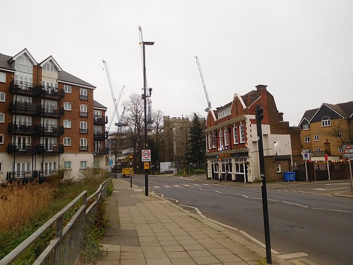
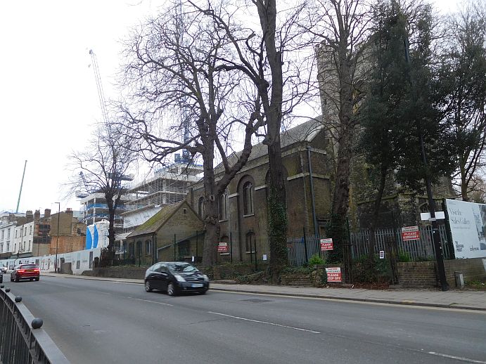
These three photos were taken on January 23, and show the approach to the Ballymore redevelopment starting on the western side of Brentford Bridge, then walking eastwards along the High Street into Brentford.
The first photo has a good view of Canal Court (by the bridge to the right), Brentford Lock to the left and cranes. The Six Bells and St Lawrence's Church are dwarfed by the new blocks and both feature in the second photo. The third photo shows St Lawrence's with Block B beyond it.
Janet's fourth photo was taken on 31 Jan 2022 looking down Catherine Wheel Road. Some notes follow this photo.
 |
 |
 |
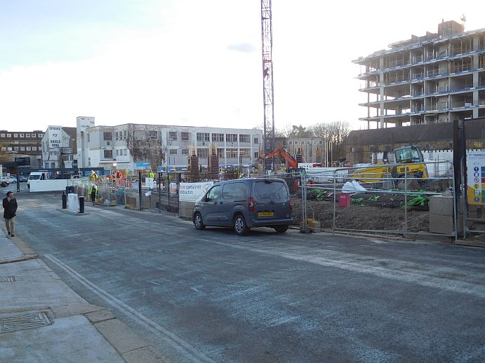 |
In the photo above the wording on the two buildings is "Sparks fly anvils ring" and "The tide calling ... ".
Janet also forwarded a notification of work due on 29 January 2022:
You may be aware that Willmott Dixon have been appointed by the London Borough of Hounslow to construct 96 Nr Local Authority Apartments within Block D as part of the wider Brentford Waterside redevelopment
and continues to explain a second Tower Crane was due to be erected.
Links
Similar view to the first photo, 2008, thanks to Dave Stoneleigh.
Similar view to the second photo, 1966, thanks to Diane Lockie
Janet's earlier photo of the site includes a satellite view that shows the extent of the current phase of development and a plan from Ballymore showing Plots A-L.
Other photos by Janet charting the new development.
Published February 2022