
Basics
Home and SearchSite Guide
Brentford Basics
Privacy Policy
Contact
People
FamiliesPhotos of people
Name indexes incl WW1
Memories
Lists, Documents, News
Occupations
Properties
Properties: High StreetProperties: non-High Street
Photos
Maps
1909/10 Valuation Index
Pub Hub
Can You Help?
Seeking...Mystery photos
Roads Off
A-Z listJanet's Research
HistoryBeach's Jam
Nowell Parr
Turner the Artist
Queen Victoria 1840
Brentford Market
80 High Street
Clitherow of Boston House
Four Croxford Brothers
Sources & More
They SaidBooks etc.
Web Links
Next
Site Technology
Author
Home and Search
Not Brentford
Tithe Map of Ealing showing Drum Lane (Ealing Road) and to the east, Old Brentford, 1839/41
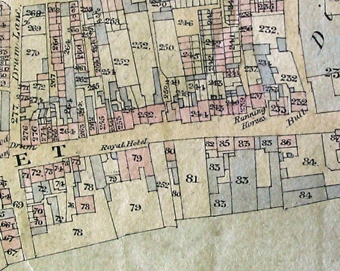
This image is reproduced courtesy of Corporation of London, London Metropolitan Archives
The property numbers on the map are those used in the tithe apportionment and are not the same as the house numbers allocated in 1876.
Published 2005